10 Innovative Use Cases for Drone-Mounted Geophysical Sensors
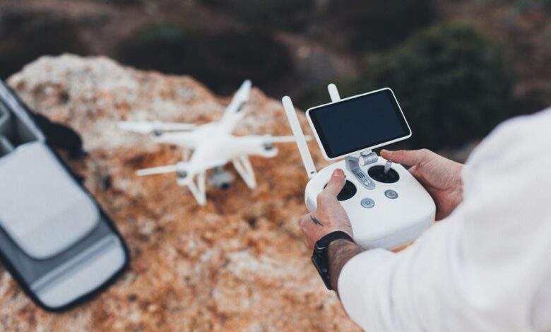
Drone-mounted sensors are a breakthrough that enables efficiency, accessibility, and safety in geographical mapping, survey, and industrial applications. Equipped with UAV thermal cameras and EM sensors and more, they offer efficient alternatives to traditional processes.
Drones are used in modern geophysical research as a research and exploration device that allows people to explore, survey, and examine hard-to-reach areas. With the development of newer technology, drone-mounted sensors are being used by several industries in innovative ways.
This article explores 10 innovative and impactful use cases for drone-mounted geophysical sensors that use UAV Thermal Cameras, UgCS GPR, EM sensors and more.
Understanding Drone-Mounted Geophysical Sensors
Drone-mounted geophysical sensors refer to lightweight, high-resolution sensors that are mounted on UAVs as a payload for survey, exploration, and monitoring. Some of the most common sensor types used for this purpose include magnetometers, GPR, LiDAR, multispectral, EM sensors, and thermal cameras.
This method provides the following advantages over traditional ground and aerial survey methods:
- Increased speed and efficiency.
- Cost-effective data collection
- Operation in hazardous and inaccessible areas.
- Precise operations and data quality
- Real-time data collection and feedback
- Versatility regarding sensor usage and payload capabilities.
10 Innovative Use Cases for Drone-Mounted Geophysical Sensors
Drone-mounted Geophysical Sensors, such as UAV Thermal Cameras and UgCS GPR, can be used in the following ways:
1. Mineral Exploration in Remote Terrains
UgCS GPR (Ground Penetrating Radar) can be used to map magnetic anomalies for ore deposits. This can reduce the costs of exploration and risks in harsh environments.
2. Oil and Gas Prospecting
Electromagnetic surveys and UgCS GPR can be used for subsurface mapping. This makes prospecting faster and safer than manned aerial surveys.
3. Groundwater Detection
EM sensors and UAV thermal cameras can be used to identify aquifers. This is an important application in water-scarce regions and can help with resource planning.
4. Archaeological Site Mapping
UgCS GPR can be used for the non-invasive detection of buried structures. This can help archaeologists preserve sites without excavation.
5. Environmental Monitoring
UAV thermal cameras can be used for detecting soil contamination and pollutant spread. These are excellent devices for post-disaster assessments.
6. Volcanic and Seismic Hazard Monitoring
Mapping fault lines and lava flow structures can be done with safety, ease, and accuracy using UAV thermal cameras. Thus, these are an effective way to safely gather real-time data in high-risk zones.
7. Coastal and Marine Studies
UgCS GPR and magnetometers can be used for shallow seabed mapping, the data being of significant use to coastal and marine studies. The data from these can used to prove coastline erosion and support ecosystem research.
8. Infrastructure and Urban Development
Pre-construction subsurface surveys can be done with both electromagnetic sensors and thermal cameras. This data can be used to mitigate and avoid risks during tunnelling or foundation works during major construction processes.
9. Agriculture and Soil Analysis
Multispectral cameras and EM sensors can be used for mapping soil properties and moisture. This imparts precision in farming applications, helping farmers plan their resources and cropping schedules for maximum yield.
10. Military and Security Applications
EM sensors and UAV thermal cameras are used for mapping and surveillance in military operations. They can also be used to detect underground tunnels or mines, thus enhancing defence-related geophysical intelligence.
Comparing the Use Cases of Drone-Mounted Geophysical Sensors
The uses cases of drone-mounted sensors and benefits offered for each are listed as follows:
| Use Case | Primary Sensor Type | Key Benefits | Industry Application |
| Mineral Exploration | Magnetometers, EM Sensors | Identifies ore deposits, reduces exploration costs | Mining |
| Oil and Gas Prospecting | EM Sensors, GPR | Safer subsurface mapping, faster survey times | Petroleum drilling and extraction |
| Groundwater Detection | Electromagnetic Sensors | Locates aquifers, supports water resource planning | Agriculture, Municipal |
| Archaeological Site Mapping | GPR, Magnetometers | Non-invasive, preserves heritage sites | Archaeology, Heritage Conservation |
| Environmental Monitoring | Multispectral, EM Sensors | Detects soil contamination, pollutant mapping | Environmental Agencies |
| Volcanic and Seismic Hazard Monitoring | Magnetometers, LiDAR | Real-time hazard data, safe remote access | Geohazards and Disaster Management |
| Coastal and Marine Studies | Magnetometers, GPR | Shallow seabed mapping, erosion tracking | Marine Research, Coastal Planning |
| Infrastructure and Urban Development | GPR, EM Sensors | Identifies subsurface risks before construction | Civil Engineering, Urban Planning |
| Agriculture and Soil Analysis | Multispectral, EM Sensors | Soil property mapping, moisture detection | Precision Farming |
| Military and Security | Magnetometers, GPR | Tunnel/mine detection, enhanced surveillance | Defense and Security |
Table 1: Exploring the Use-case Scenarios of Geophysical Sensors
Comparative Benefits Over Traditional Methods
Drone-mounted geophysical sensors can be cost-effective, offer higher resolution and faster data acquisition, and have a reduced environmental footprint. They are also a great option for accessing hard-to-reach areas.
A feature-wise comparative table between the two is given below:
| Feature | Drone-mounted geophysical sensors | Traditional Geophysical Methods |
| Speed and efficiency | High | Low to moderate |
| Cost | Cost-effective in terms of overheads | Higher costs of logistics |
| Accessibility and safety | High | Limited |
| Data resolution | High | Depends on the method |
| Depth of investigation | The altitude of the drone can cause signal degradation | Varies by method |
| Logistics and Scalability | Easy | Complex |
| Accuracy | High | High |
Table 2: Comparison of Drone-mounted Geophysical Sensors With Other Methods.
Challenges and Future Trends
Though the technology associated with drone mounted sensors have made serious growth, limitations are still present in terms of battery life, payload capacity, and regulations. However, emerging technologies like AI-driven mapping and swarms of drones can be used to further improve the efficiency and accuracy of the procedures.
Some predictions for broader adoption across industries are as follows:
- Advancement in Micro-Electro-Mechanical systems for smaller, lighter, high-resolution sensors.
- Sensor fusion to combine data collected in various modes for enhanced accuracy.
- Integration of AI and Machine Learning.
- Advanced imaging techniques, for instance synthetic aperture radar for all weather imaging.
Wrapping Up
Drones with geophysical sensors are a transformative tool across multiple fields. They are one of the most versatile evolving technology finding applications from mining to archaeology to disaster management. Further, their future potential is expanding rapidly with tech advancements.
Improving Efficiency With Drone-Mounted Geophysical Sensors
Ready to explore drone-geophysics partnerships or R&D opportunities? Take a look at the top UAS and geophysical service providers for your specific industry needs.